Water Quality Monitoring System
to drive strategic and data-driven decision making to protect aquatic ecosystem
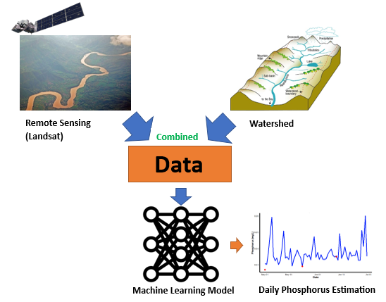
How does it work?
-
Step 1
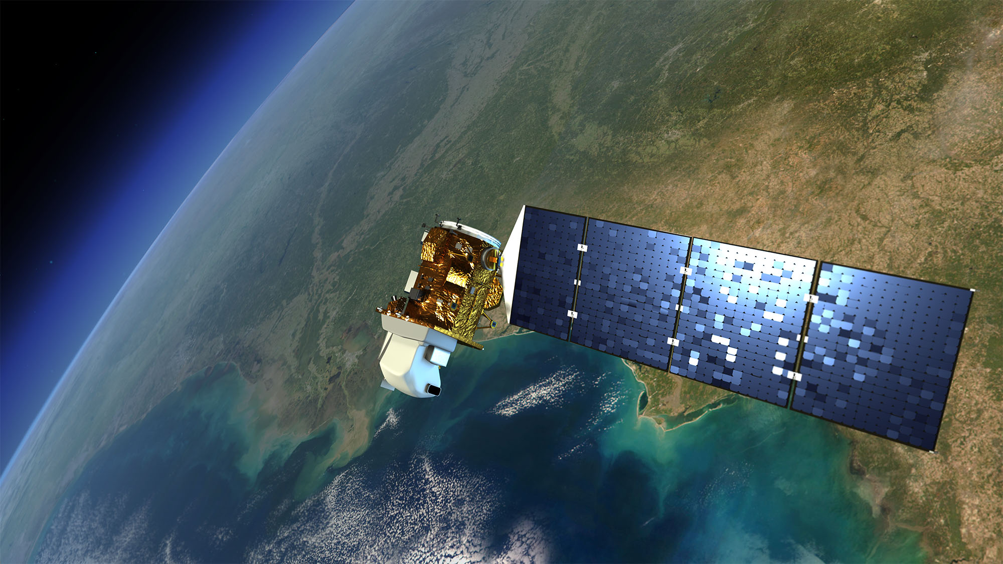
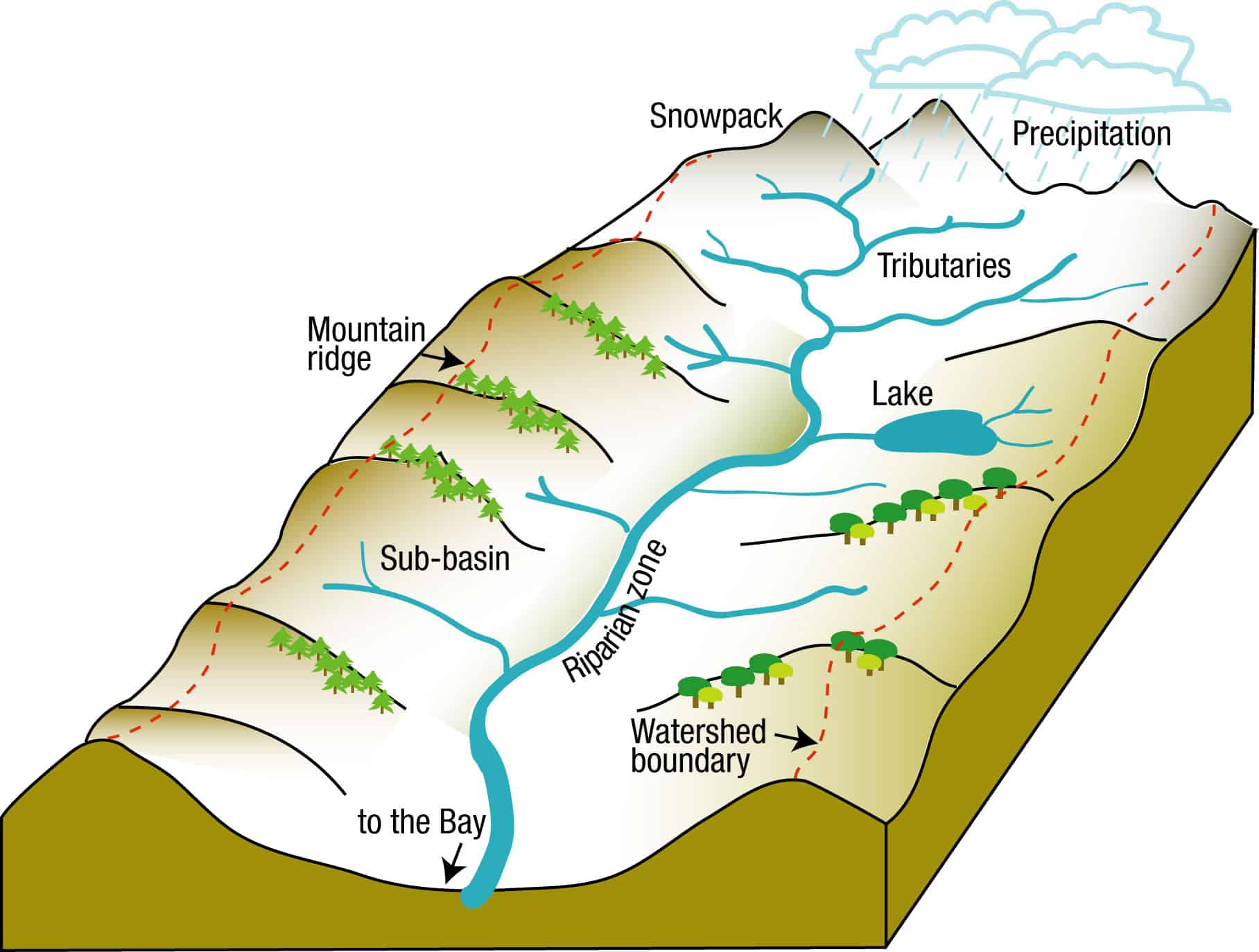
Extract Landsat satellite river data from Google Earth Engine and watershed data from HydroAtlas(open database).
-
Step 2
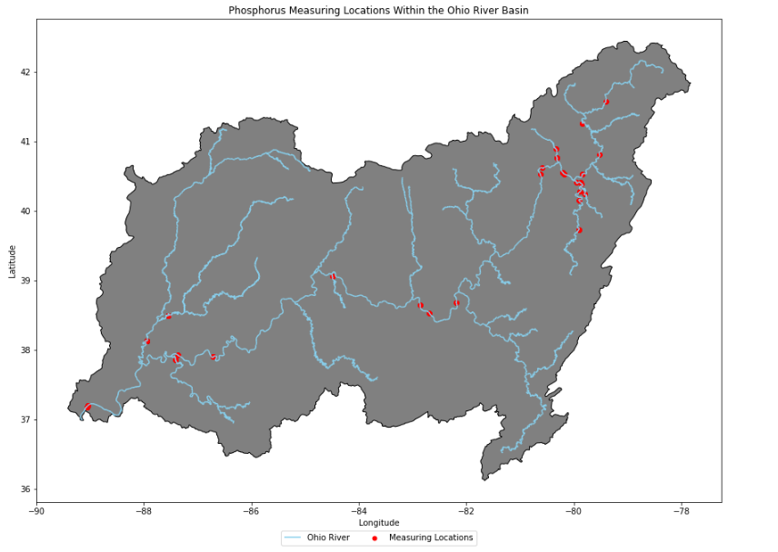
Extract on-site river phosphorus measurements from the Water Quality Portal (Web database).
-
Step 3
Use the extracted data to develop the Machine Learning model.
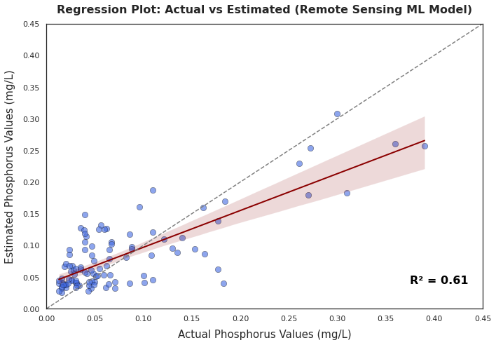
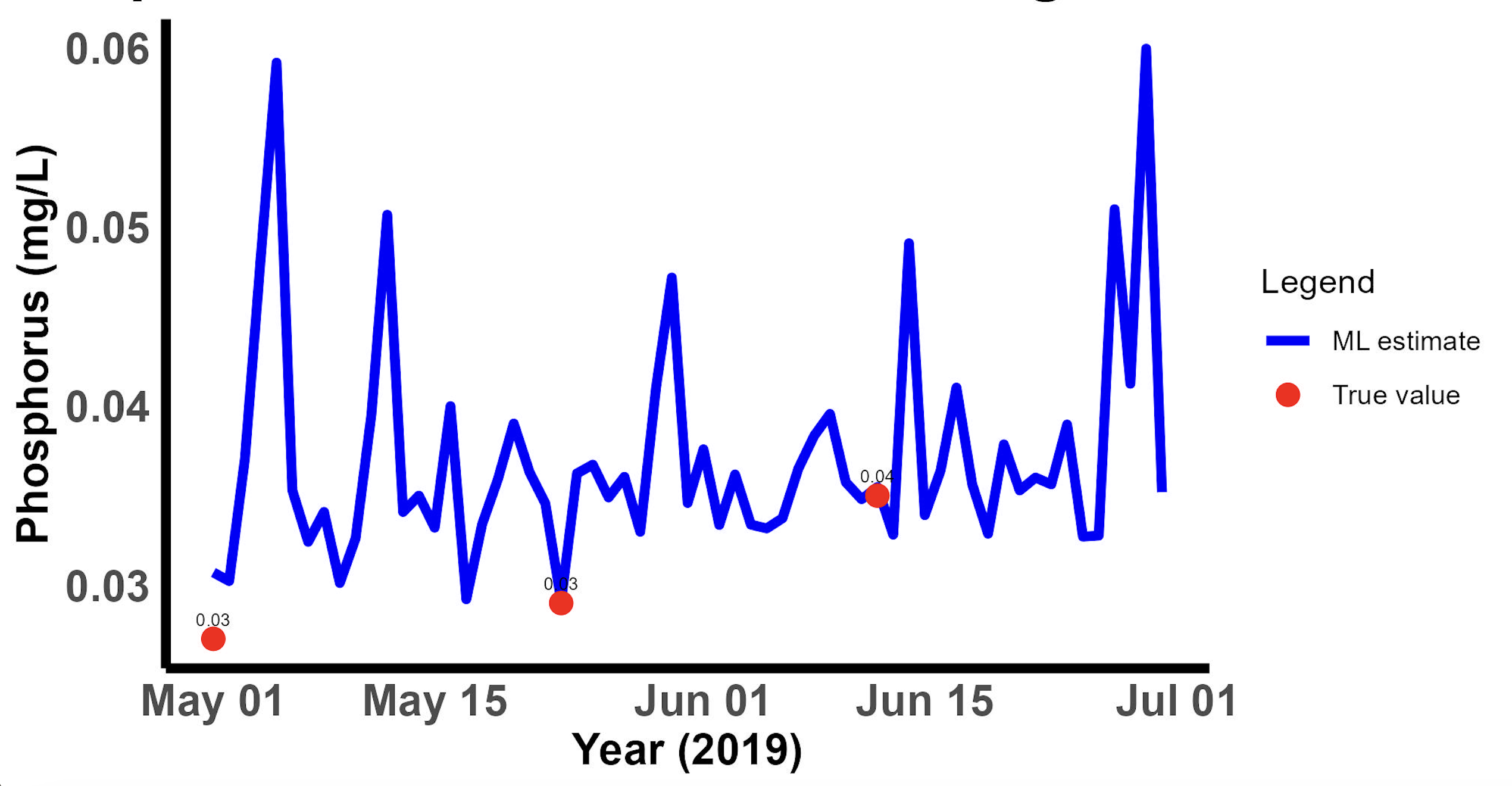
Machine Learning Model Result
Satellite Image
Machine Learning Model Performance
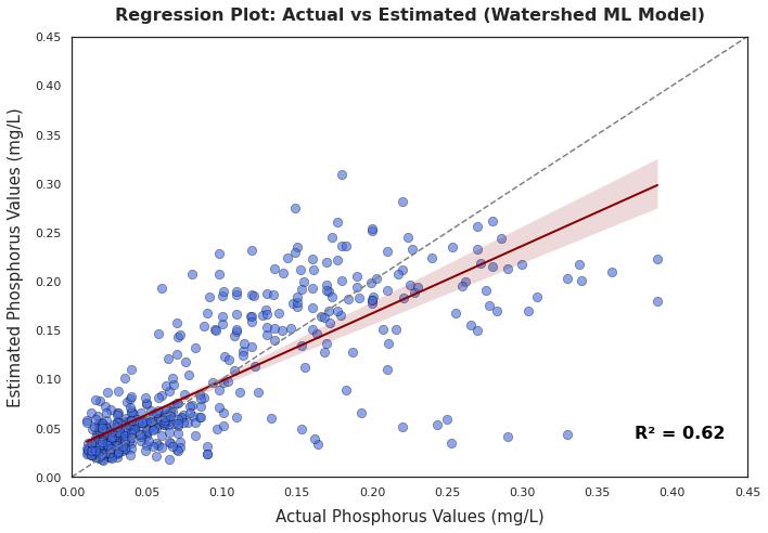
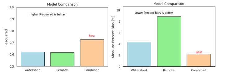
Model Improvement with Combined Data
Our results show that both remote sensing and watershed-driven machine learning models are individually effective at estimating phosphorus levels in rivers. However, when combined, they enhance the accuracy of the estimations. By integrating the strengths of both data sources and models into a unified machine learning approach, we achieve more precise phosphorus estimations. The comparison figures (bar plots) clearly demonstrate that merging these datasets significantly improves overall accuracy. Given that both sources are freely accessible, leveraging them can enhance estimation capabilities, contributing to better water quality monitoring in rivers. This, in turn, supports environmental protection and the preservation of aquatic ecosystems.
Future Work
Future work involves scaling the project to include all rivers in the United States and supporting the monitoring of phosphorus levels. This will be achieved by using data scraping and direct data optimization to collect and process data, which will then be fed into an ML model to provide daily estimations for real-time monitoring and assessment of riverine phosphorus. Additionally, satellite imagery will be leveraged to estimate phosphorus levels along the river's length and study its dynamics. Ultimately, this approach will provide daily estimations for all rivers, offering a deeper understanding of water quality and the dynamics of phosphorus in rivers across the United States.